
Itinerary: from Oaxaca - in the west - through the Isthmus of Tehuantepec to Chiapas, in the east
Reed and I enjoyed memorable meals in Oaxaca, such that Reed was moved to suggest, "We may have to make regular trips to Oaxaca...to eat!" I've read that of the world's cuisines, Chinese is #1 (because of the complexity of the seasonings); Mexican-Oaxacan is #2; and French is bumped to #3!
Next day we made a return visit to the important Zapotec archaeological site, Monte Albán. I ambled around the plaza while Reed climbed pyramids. The Zapotecs leveled a strategic mountaintop to create this space, which commands valleys on either side. The plaza is accessed by climbing down into the plaza. The plaza itself is oriented north-south, and its pyramids and temples define the space. Anyone standing in the plaza knows exactly where he/she is located.

From Oaxaca we traveled by bus from about 6,000 feet down to the Isthmus of Tehuantepec at sea level. The road was incredible: switchback after switchback with high valleys of maybe .5 to 1 mile across. (Dramamine recommended for carsick-prone travelers.)
From Tehuántepec we were able to look north (the Isthmus runs east-west) to an absolute wall of mountains rising precipitously from the plain. Thanks to an excellent topographic map, we were able to see where the tectonic plates (Caribbean plate and Cocos plate) come together to mark the boundary of the North American plate (continent). Equally amazing were mile after mile of wind farms—on both sides of the highway.

Sierra Madre del Sur
Next day we traveled by bus up to the Spanish colonial city of San Cristóbal, which was interesting but, in our opinion, poses no competition for Pátzcuaro. Its architecture is Spanish colonial, in part, but also 19th century French. Plus it is overrun by tourists from Europe! This was a phenomenon we were to see later in Chiapas. Many French tourists.
Groping for words to describe the scene, Reed came up with "it's like an outdoor mall"—and, honestly, he's not far off. We're used to Pátzcuaro, which is a working city even when there are tourists around—and, of course, Pátzcuaro’s Centro (downtown area) is 100% Spanish colonial architecture protected by the Municipality. Wandering away from the city center, we were more comfortable in San Cristóbol’s neighborhoods—each with its own small plaza. It was a pleasant stay, but after three days we were ready to leave.
I.
We traveled by bus down through the Chiapas mountains, to the small city of Ocosingo, where we stayed overnight so we could visit the Maya ruins at Toniná. It has to be said: the countryside on this trip was spectacular.
Keep in mind that we were at 7,000 ft in San Cristóbol. Now consider that the highway climbs out of San Cristóbol before descending into another valley that probably took us an hour to cross—perhaps 50 miles across? For one thing, the landscape is green, even though it's near the end of the dry season (rains come in May). We're talking about cattle ranches, horses grazing, fields of corn growing their tassels, orchards of palm oil trees, banana and other fruit plants. Our little noses were pressed against the window.
From the valley, the highway again climbs before descending to cross yet another valley—this pattern was repeated four or five times. We really couldn't believe the grandeur of the countryside—big 'western' skies, long horizons, stark mountain ridges. At times the highway followed along a ridge top; small pueblos with access to the mountain slopes on both sides for corn fields and palm oil orchards are spaced about every five miles.
I can't imagine what it would be like to work these fields—everything is up or down—nothing is flat. The word that comes to mind is the Spanish noun aguante (forbearance), or the verb aguantarse (to put up with). My Spanish teacher commented that aguante is the very heart of Mexican culture. When children are whining, complaining or resisting what has to be done, a mother will say, "Aguántese!" (Pull yourself together).
Another example: last winter Reed and I were in the airport at Morelia at 1 AM, waiting to board the plane for a red-eye flight to Chicago, when coincidentally we met our Mexican friend, Norma. A grandmother, Norma has seen it all, so when we complained about the hour and our tiredness, Norma replied, "We Mexicans are like the burro—we just keep working." I'd bet any amount of money that it was aguante she had in mind. Were we her children or grandchildren, she would have replied, "Aguántese!"
This is Zapatista country—remember Subcomandante Marcos? I was impressed by the appearance of schools and health centers in the pueblos, which are about 5 miles apart. This reminds me of New England, where the villages are about five miles apart—that’s about an hour and a half walk between! Later our driver told us that the Zapatistas' activism has become a recognized political movement and "things are much better now; there are schools and health services where there were none before."
We got to Ocosingo at about noon. After a quick lunch, we went by taxi out to the ruins. Again, we were awed by the sheer lush beauty of the countryside—lots of grazing beef cattle, but they're not like our white-face Herefords; they're the taupe color of Brahma bulls.
At the ruins we walked about a half-mile down a stone-paved track to the entrance of the ruins, but it was the end of the road for me. No way was I able to climb down the stairs of a steep gulley and up the other side. Plus the guide told us that was just the beginning—the temples themselves are cut into the hillside, so it's up-up-up, then down-down-down.

For me, the 'cross' formed by the 'mirror-image' pyramids representing the Milky Way (broad vertical stones) and the Sun's path across the sky (East-West horizontal) is the most meaningful, because this symbol is core to Mesoamerican beliefs.

So, I decided to enjoy the peace, quiet and incredible view by having a Cappuchino at the snack shack built Maya-style with a thatched roof and open sides. As I sat down at a table, I noticed that a bull was grazing away on the track about 50' from me. Hmm. No rope. No nothing. Then I was joined by a rooster who—positioning himself more or less at my feet—loudly and repeatedly demanded his share. It was a first: never have I shared my Cappuchino with a bull and a rooster!
After a bit more chomping, the bull gave me a studied look—I didn't move, and found somewhere else to look—before he ambled quietly away. I asked the woman behind the counter about the bull. She looked amused as she replied that he's okay—he just got out of the field. Gulp. Then I discovered she lives in the house next door and her husband works on the ranch. We had a lovely chat. Today I mentioned to my (male) Spanish teacher about differences between bulls here in Mexico and those in the United States. As a youngster he helped out on the rancho of one of his uncles; there, from the beginning, bulls are treated more like pets than like wild animals. So it stands to reason that they are really quite calm.
Next day we left for Palenque, said to be the crown jewel of Maya sites. Palenque did not disappoint. I had visited Palenque almost 20 years ago when I worked for Pemex, and I could hardly believe the work that has been done since then—a lot more archaeological excavation and the construction of tourist facilities, including a small but superb museum housing artifacts uncovered at the site.

II.
A couple of experiences captured a lot of how I feel about Mexico. Reed and I have a tough time being treated like American tourists (which, of course, we are). But nonetheless, we bridle at being answered in English when we speak in Spanish, but most of all we find it difficult to be treated more like a commodity than like a human being. At our hotel in Palenque, the waiters—who attend to tourists from all over the world—at first treated us like rather stupid objects. But we persisted speaking Spanish and treating them with respect. After a couple of days, they responded and began to treat us as persons. One waiter name Iván (!) asked if we'd like to visit his pueblo, which is now a colonia (neighborhood) of Palenque about 5 minutes taxi ride from the hotel.
So the next morning we rode with Iván to his neighborhood. After meeting his lovely wife and three children (6, 4, 2), all seven of us set off on a walking tour. The houses are humble, cinder-block construction about 15’ x 30’ (I’m guessing). Iván rents his house for 700 pesos a month (about $60). I’m also guessing that the dirt road that passes in front of their house sees more foot than vehicular traffic.

His six-year old son was eager to tell us the names of the various trees we passed. He was also intent on picking a flower from every bush and giving it to us to make a bouquet.

Chatting and laughing, we made our way across the railroad tracks to the Plaza, where we sat on a stone wall under the deep shade of a well-placed tree while our host introduced us to passersby.
As we sat, Iván told us about the pueblo’s fiestas—when the Plaza is full of people, and there are puestos (vendors’ stalls) all around the outside perimeter, and the fireworks, and the music and dancing, and carnival rides for the kids. As Iván spoke, his pleasure in and commitment to his pueblo was clear. In Spanish, the word pueblo has two meanings: it refers not only to the place, but also to the people who inhabit the place. Iván's description was a striking reminder of how central fiestas are to Mexicans' sense of themselves—who they belong to and who belongs to them.
III.
The next experience happened at Palenque’s archaeological site itself. You know Reed’s photographic portraits. Well, there were several groups of young people (junior-senior high school) visiting the ruins that day. One young woman came to stand quietly next to me...then I realized her friend had taken our picture. When I asked if she wanted her picture taken with me, she nodded yes, so I asked why. Shy, she hesitated to reply, so I asked, "Is it because I'm so güera (paleface)?" She smiled and said, "Yes." So I said, "Well, it's okay to have your picture taken with me"—at which point, the entire group of about 15 girls crowded around me for a group picture!
At that point, I think my young friend asked where I'm from. I replied, "I'm from the United States, but I hope now we're friends"—she gave my elbow a quick, lovely squeeze accompanied by a warm, even grateful, smile. I'm still not sure why the girls wanted their picture taken with me, but I'm absolutely sure of the goodwill that accompanied it. If any of you have any inclination to learn Spanish, follow up on it! Knowing the language opens a window on this diverse and endlessly fascinating culture.
The next day we traveled to two waterfalls, one called Agua Azul, Blue Water.
The following day, Reed took an all-day tour to two Mayan sites. Yaxchilán is in the jungle, on the Mexican side of the Usumacinta River which forms the boundary with Guatemala. Bonampak, famous for having the only surviving Mayan murals, is nearby.


IV.
From Palenque we traveled by bus down to the city of Villahermosa on the coastal plain (Gulf of Mexico). From there we went by taxi out to Comalcalco, the most westerly Maya site. Comalcalco was really different. For one thing, the site is on the coastal plains—nary a mountain to be seen. For another, the coastal plain lacks stone for building, so the Maya constructed the pyramids by first piling earth then covering the dirt with stucco. They also baked tiles similar to the curved, red tiles we have on our roofs here in Pátzucaro (and throughout California and the Southwest), and stacked them like bricks to build the temples on top of the pyramids. Reed observed that although all the Maya sites share common elements, each site is also unique.
Again, a small but tasteful museum displayed artifacts uncovered at the site. What impressed us was the humanity of the faces carved on the statues; they felt like real people—character was evident in the faces. Plus they were carved front-on, facing us. At Palenque, they are carved in profile—similar to those of Egyptian pharaohs. The frontal view communicates much more immediately and directly.
But the vegetation on the coastal plain is truly something else. Some years ago Olmec relics were discovered at the site of what was to become the oil field named La Venta. A Mexican poet supported the excavation and removal of the artifacts (large Olmec heads, thrones and other objects) to a jungle park in Villahermosa.

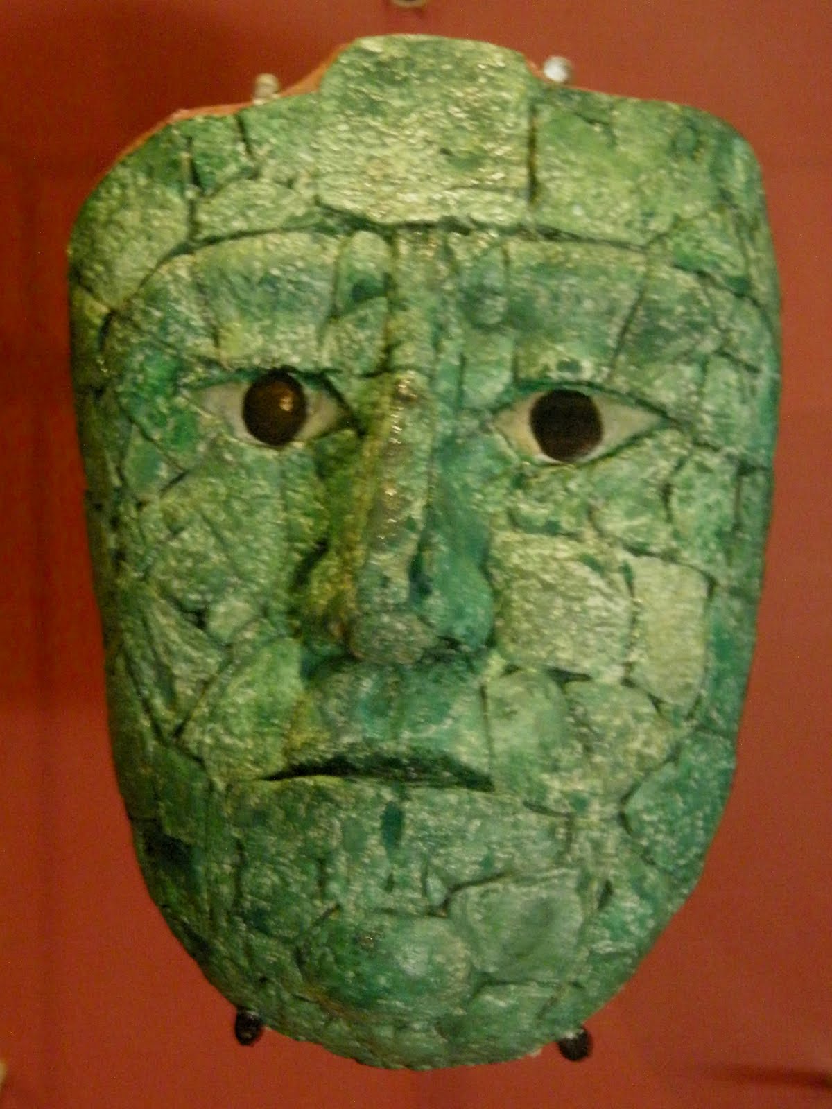
Olmec photo album
We walked a deeply shaded path through the jungle where these artifacts are now displayed about 30' apart. It was a remarkable 2-hour walk. We noticed that several of the pieces are currently [March, 2011] on loan to the DeYoung Museum in San Francisco, California. Even the copies are impressive, but those of you in the Bay Area might enjoy seeing the originals!
Equally remarkable was the jungle vegetation! We were grateful for signage giving botanical names of the plants. Are you ready for this? Having lived in the Eastern United States, we were used to growing the humble Pothos as a low-light houseplant. But when Pothos is planted in the ground in the tropics, it gets a little more sunlight and (I suspect) more humidity, the leaves are about 10" across (dinner plate size!) with stems a good 1/2-3/4 inch in diameter! I kid you not. We saw Pothos this large in the courtyard at the hotel in Palenque and again on the jungle walk. A little disconcerting, but fascinating!
Sunday we flew home. I can't tell you how good the mountain air felt when we got off the plane in Morelia. Cool, dry air—we're home!
So that's our big adventure. We're already planning a return trip to Chiapas next winter. Our trip across Chiapas this time was basically southwest to northeast—next time we'll focus more on the southeast and include a trip to Tikal (with Palenque, two of the most important Maya cities) in Guatemala. Stay tuned!
No comments:
Post a Comment